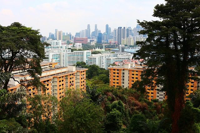
Singapore isn’t just skyscrapers and city streets, its lush greenery and scenic trails make it a top destination for outdoor enthusiasts. Hiking in Singapore 2026 offers everything from serene forest paths to challenging hilltop treks, perfect for both beginners and experienced hikers.
This guide highlights 15 of the best hiking trails in Singapore, providing essential details like difficulty, distance, location, and insider tips. Discover the most picturesque routes, hidden nature gems, and immersive experiences that make hiking in Singapore an unmissable adventure.
15 Best Hiking Places in Singapore
From the towering treetops of MacRitchie to the historical sites of Fort Canning Park, Singapore’s hiking spots showcase the island’s incredible natural beauty and rich heritage. Here’s our pick of the 15 best hiking places in Singapore:
- 1. MacRitchie Treetop Walk
- 2. Southern Ridges
- 3. Bukit Timah Nature Reserve
- 4. Dairy Farm Nature Park
- 5. Kranji Marshes
- 6. Fort Canning Park
- 7. Coney Island
- 8. Chestnut Nature Park
- 9. Upper Seletar Reservoir Park
- 10. Rail Corridor
- 11. Tampines Eco Green
- 12. Rifle Range Nature Park
- 13. Windsor Nature Park
- 14. Sungei Buloh Wetland Reserve
- 15. The Learning Forest
- FAQs
1. MacRitchie Treetop Walk
MacRitchie Treetop Walk is one of the most iconic hiking trails in Singapore. This 250-meter suspension bridge rises above the forest canopy, giving hikers panoramic views of the lush greenery below. It’s a must-visit for anyone seeking one of the best hikes in Singapore.
- Difficulty: Moderate
- Distance: 7-11 km round trip, depending on route
- Location: Venus Dr, Singapore
- Cost: Free
- Great for: Nature lovers, birdwatchers, photographers
- Key Tips: Go early to beat the crowds and heat. Bring water and snacks as there are limited facilities along the trail.
Suggested Read: Singapore Visa Rejection Reasons & Approval Tips
2. Southern Ridges
The Southern Ridges is a 10 km trail linking Mount Faber Park, Telok Blangah Hill Park, and Kent Ridge Park. Highlights include the wavy Henderson Waves bridge and the elevated Forest Walk, making it one of the best hiking places in Singapore for scenic strolls.
- Difficulty: Moderate
- Distance: 10 km one way
- Location: Marang Trail, near Harbourfront MRT
- Cost: Free
- Great for: Panoramic city views, nature walks
- Key Tips: Allow 3-5 hours to complete the full route. The trail is well-marked but involves many stairs, so wear comfortable shoes.
Planning a holiday in Singapore? Apply for your Singapore visa through OneVasco for quick processing and a seamless experience.
Suggested Read: Singapore Visa Appeal For Indians
3. Bukit Timah Nature Reserve
Bukit Timah Nature Reserve features Singapore’s highest hill and one of the largest patches of primary rainforest. Multiple trails cater to both beginners and seasoned hikers, making it a top choice among hiking spots in Singapore.
- Difficulty: Easy to challenging
- Distance: 1.2-7 km, depending on route
- Location: Hindhede Dr, Singapore
- Cost: Free
- Great for: Wildlife spotting, forest bathing
- Key Tips: Look out for monkeys and monitor lizards along the trail. The visitor center has educational exhibits on the local flora and fauna.
Suggested Read: Singapore Visa Extension

4. Dairy Farm Nature Park
Dairy Farm Nature Park was once a cow farm and now offers easy walking trails through secondary forest and grasslands. Don’t miss the Wallace Trail, with informative signs about Alfred Russel Wallace, co-developer of the theory of evolution.
- Difficulty: Easy
- Distance: 1-4 km, depending on route
- Location: 100 Dairy Farm Rd, Singapore
- Cost: Free
- Great for: Families, history buffs, and easy nature walks
- Key Tips: Visit the nearby Singapore Quarry for wetland bird-watching. The park has shelters for picnicking.
Suggested Read: Singapore Visa For Indians
5. Kranji Marshes
Kranji Marshes is one of Singapore’s largest freshwater wetlands and a prime site for birdwatching. A short trail leads to the Raptor Tower, providing sweeping views over the marshlands, a hidden gem among hiking places in Singapore.
- Difficulty: Easy
- Distance: 1 km
- Location: 11 Neo Tiew Lane 2, Singapore
- Cost: Free
- Great for: Birdwatchers, wildlife enthusiasts
- Key Tips: Visit in the early morning or late afternoon for the best chance of spotting birds. Bring binoculars and insect repellent.
Suggested Read:Singapore in February
6. Fort Canning Park
Fort Canning Park is steeped in history, once home to Malay royalty and colonial-era events. Walking trails here wind past ancient artifacts and lush gardens, combining culture with nature for one of the most unique hiking spots in Singapore.
- Difficulty: Easy
- Distance: 2-3 km
- Location: River Valley Rd, Singapore
- Cost: Free
- Great for: History lovers, picnickers, joggers
- Key Tips: Check out the Battlebox Museum to learn about the park’s WWII history. The Spice Garden is especially lovely.
Suggested Read: Singapore With Kids
7. Coney Island
Coney Island Park is a rugged coastal island in the northeast. A 2.4 km paved loop winds through mangroves and coastal forests, passing iconic Casuarina trees, making it a favorite among hikers looking for less crowded hiking trails in Singapore.
- Difficulty: Easy
- Distance: 2.4 km loop
- Location: Beside Punggol Promenade Nature Walk
- Cost: Free
- Great for: Families, cyclists, forest walks
- Key Tips: Rent a bike to explore the island. No food or drink is sold, so pack your own. Toilets available.
8. Chestnut Nature Park
Chestnut Nature Park features separate trails for hiking and mountain biking. Its forested paths occasionally open to reservoir views, appealing to those searching for the best hikes in Singapore with both adventure and scenery.
- Difficulty: Easy to moderate
- Distance: 1.5-5.6 km, depending on route
- Location: Chestnut Ave, Singapore
- Cost: Free
- Great for: Escaping the city, forest hikes
- Key Tips: Combine hiking with a visit to the nearby ORTO leisure park. Parking is limited so arrive early.
Suggested Read: Singapore Monuments
9. Upper Seletar Reservoir Park
A peaceful spot for hiking in Singapore, Upper Seletar Reservoir Park has a 4 km walking trail with scenic water views. It’s a popular place for kayaking and fishing too.
- Difficulty: Easy
- Distance: 4 km
- Location: Along Mandai Rd
- Cost: Free
- Great for: Waterside walks, joggers, families
- Key Tips: Rent a kayak and paddle around the reservoir. Visit the Mushroom Cafe for local snacks.

10. Rail Corridor
The Rail Corridor follows a former railway line that once connected Singapore to Malaysia. Though parts are still under development, a 4 km stretch from the conserved Bukit Timah Railway Station to Holland Green is open for hiking and cycling.
- Difficulty: Easy
- Distance: 4 km (partial)
- Location: Starts near King Albert Park MRT
- Cost: Free
- Great for: Urban explorers, history buffs, easy walks
- Key Tips: The trail is not well-shaded, so avoid midday. Several bus stops provide access along the route.
Suggested Read: Singapore Visa Photo Size Requirement & Specification Guide
11. Tampines Eco Green
Tampines Eco Green is a 36-hectare park with grasslands, freshwater wetlands, and a secondary rainforest. Well-marked trails and boardwalks make this an ideal place for a relaxing nature walk.
- Difficulty: Easy
- Distance: 1.5 km
- Location: Tampines Ave 9, Singapore
- Cost: Free
- Great for: Birdwatchers, butterfly spotting, easy hikes
- Key Tips: Rent a bicycle and explore the nearby Tampines Bike Trail. Visit the Eco-toilet, Singapore’s first zero-energy restroom!
12. Rifle Range Nature Park
Rifle Range Nature Park features a dense secondary forest threaded with walking trails. This lesser-known hiking spot is a great place to escape the crowds.
- Difficulty: Easy to moderate
- Distance: 1-3.8 km, depending on route
- Location: Rifle Range Rd, Singapore
- Cost: Free
- Great for: Forest walks, wildlife spotting
- Key Tips: The trails can be muddy after rain, so wear proper shoes. The park is home to rare animals like the Sunda pangolin.
Suggested Read: Singapore in September
13. Windsor Nature Park
One of Singapore’s newest parks, Windsor Nature Park acts as a green buffer for the Central Catchment Nature Reserve. Hiking trails and boardwalks bring you close to freshwater streams and marshes.
- Difficulty: Easy to moderate
- Distance: 1.8-3.85 km, depending on route
- Location: Upper Thomson Rd, Singapore
- Cost: Free
- Great for: Forest hikes, nature walks, streams
- Key Tips: Look for the park’s dragonflies – over 50 species have been spotted! Visit on weekdays to avoid crowds.
14. Sungei Buloh Wetland Reserve
Sungei Buloh is a sprawling reserve made up of mangroves, mudflats, ponds, and forests. An extensive network of walking trails lets you explore this ecologically important area.
- Difficulty: Easy
- Distance: 3.6-7 km, depending on route
- Location: 301 Neo Tiew Crescent, Singapore
- Cost: Free for most areas; paid tours available
- Great for: Birdwatchers, nature lovers, wetland walks
- Key Tips: Visit during the September-March migratory season. Check tide times as some trails flood at high tide.

15. The Learning Forest
Learning Forest at Singapore Botanic Gardens offers boardwalks and elevated trails that immerse visitors in nature. Informative signs along the way share insights into forest ecology, making it one of the most educational hiking spots in Singapore.
- Difficulty: Easy
- Distance: 1 km
- Location: Tyersall-Gallop Core, Singapore Botanic Gardens
- Cost: Free
- Great for: Families, nature education, and forest walks
- Key Tips: Visit the SPH Walk of Giants to see massive trees. Stop by the Ranger Station for kids’ activities.
Suggested Read: Singapore in August


FAQs
What are the different types of hiking trails in Singapore?
Singapore has a variety of hiking trails, including:
- Forest trails (e.g. Bukit Timah Nature Reserve)
- Coastal trails (e.g. Coney Island Park)
- Wetland trails (e.g. Sungei Buloh)
- Urban trails (e.g. Southern Ridges)
- Reservoir trails (e.g. Upper Seletar Reservoir)
What is the best time for hiking in Singapore?
The best time for hiking in Singapore is in the early morning (before 10 am) or late afternoon (after 4 pm) to avoid the midday heat and humidity. If possible, avoid hiking after heavy rains as trails can be muddy and slippery.
What is the longest trail in Singapore?
The Coast-to-Coast Trail, at 36 km, is the longest trail in Singapore. It connects Jurong Lake Gardens in the west to Coney Island Park in the northeast. However, the trail is divided into sections which can be hiked individually.
Which trail has the most elevation gain in Singapore?
Bukit Timah Hill, at 163 meters, is the highest natural point in Singapore. Trails to the summit have the most elevation gain, with some sections having steep stairs or slopes.
What is the most popular and difficult trail in Singapore?
The MacRitchie Treetop Walk is one of the most popular hiking trails in Singapore. While the full 11 km loop is challenging, most visitors just do the 7 km round trip to the Treetop Walk suspension bridge. For a more difficult hike, try the Bukit Timah Summit trail.
Are there camping trails available in Singapore?
Camping is only permitted on Pulau Hantu Besar, Pulau Hantu Kecil, and St. John’s Island, which are offshore islands south of Singapore. The islands are accessible by ferry but not connected to the mainland hiking trail network. Camping in other parks and nature reserves is strictly prohibited.
Are there running trails available in Singapore?
Many of Singapore’s hiking trails are suitable for trail running too. Popular running routes include the MacRitchie Reservoir loop, Bukit Timah Nature Reserve trails, and Coney Island Park. Always be mindful of other trail users and watch your footing on uneven terrain.
Are there biking trails available in Singapore?
Yes, several parks have dedicated mountain biking trails, such as Bukit Timah, Chestnut Nature Park, and Kent Ridge Park. Pulau Ubin island also has an extensive network of biking trails through jungle and kampong (village) areas. In addition to biking, hiking in Singapore offers amazing trails for outdoor enthusiasts. Always wear a helmet and protective gear.